Here are some of the best free and almost-free deer-hunting apps available today that hunters have named in no particular order when asked about the best deer-hunting apps they use.
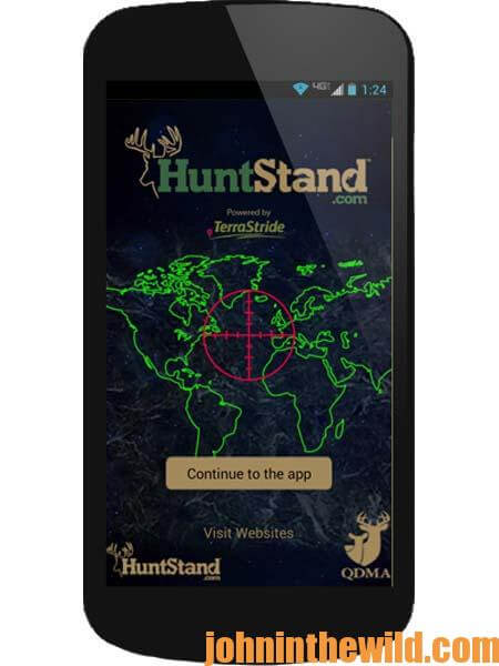 1) HuntStand – The HuntStand app is a hunting land-management tool that works whether or not you have a mobile signal. The patent pending “HuntZone” tools can calculate your scent zone based on wind direction, speed, distance and time. You can completely map out your hunting property and use any of the 40+ icons to highlight places of interest, like trail cameras, tree stands, feeder and whatever else is important to you. In addition to that, you can measure area and distance to gain accurate data on you land.
Cost: Free Android iTunes
2) ScoutLook DeerLog – This all-in-one app for deer hunters, helps them plan their hunts, manage the deer and keep abreast of weather conditions. Many of my hunting friends really like this app. It combines comprehensive weather features, including wind mapping, solunar times, tides and moon and hourly changes in barometric pressure. Hunters get real time logging that requires no typing, since the app uses simple drop-down menus. You easily can review your logs using ScoutLookWeather.com. For each locale, this app automatically tracks ratios of buck to doe, and buck ages. The app saves specific locations in fields for scrapes, rubs, water holes, food, camera sites and blood trails, among others. The weather details pinpoint environmental conditions, so you can make the most of your hunt.
Cost: Free Android iTunes
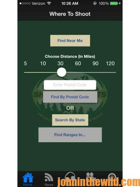 3) Where to Shoot – This app, which uses your location services or GPS to search for nearby gun ranges is maintained by the National Shooting Sports Foundation (NSSF). It uses NSSF’s extensive database of shooting ranges across the United States and Canada to name where you can shoot when out of town or in unfamiliar places. Also included in the app are videos of shooting tips and resources.
Cost: Free Android iTunes
4) ScoutLook Hunting Weather – This app shows you the weather at your exact hunting location using geocoding and is used by many of my outdoor friends in conjunction with the ScoutLook Deer Log. It effectively integrates details like radar and wind with solunar times and phases and hourly changes in the barometer, all information that a hunter will need when deciding when and where to hunt. The app shows you 72-hour wind forecasts visually with ScentCone and SetZone. When you know the full range of wind data that affects your hunting, then selecting the right tree stands and duck blinds is much easier.
Cost: Free Android iTunes
5) PocketRanger – PocketRanger is a series of apps that provide you in-depth information about state and national parks and give hunters easy access to park information, such as hours, telephone numbers, trails, campgrounds and GPS terrain maps. It also can assist you in locating places to hunt, knowing the rules and regulations, as well as specific license and permitting information for each park.
Cost: Free http://www.pocketranger.com/
6) Hunt Predictor – Featuring a highly-advanced prediction formula, this app lets you plan your hunting times for deer, turkeys and waterfowl. You can ensure the best results by making use of its algorithm that uses seven variables to interpret weather patterns scientifically, which in turn helps you predict the movement of wildlife. Using GPS technology, it provides you with 5-day hunting predictions for your next hunting trip. Make the most of your time by getting up-to-date information about when wild game is on the move. Check the Go Hunt or Stay Home graph to be efficient with your hunting schedule. Plot your locations, and manage all your data for each hunt. View hourly weather forecasts, and check sun and moon times for your best hunting outcome.
Cost: Free Android iTunes
7) Shooting Hours – Shooting Hours is a sunrise and sunset calculation app that uses your GPS location to determine the times of morning and evening when animal activity will be the highest. This app replaces the need for sunset and sunrise tables and eliminates the guesswork wondering if the tables are accurate. Use the custom shooting hours’ settings to adjust for your local hunting regulations, so you are always sure of the legal hunting hours in your specific state. The app will vibrate your phone to notify you of the start and finish of the shooting hours for that day.
Cost: $0.99 Android iTunes
8) Shot Simulator – This interactive 3D app teaches you perfect shot placement for white-tailed deer hunting. The DDH Shot Simulator uses a 3D model of a deer – skeleton, organs and all – to understand the effect of shot placement and angles on the animal. The simulation provides you with step-by-step details based on the flight of your arrow or bullets to teach you how best to track and recover a shot deer. It’s an excellent visual teaching tool – not a game.
Cost: $4.99 Android iTunes
9) iHunt Journal – This app offers what you need to plan and research a hunting trip and then record your memories. You can add photos and video quickly and easily. Among its essential features are a diary, trophy gallery, statistics log, planning info, weather forecasts and the ability to manage your hunt locations. You can record the type of game, the time it was shot, amount and weight. With GPS devices, you can get an exact position, find out weather conditions like temperature and wind and check the phases of the moon. You can log shooting and escape distance, hunting areas and stands and visually lay out your hunting area using symbols to help planning.
Cost: $5.99/$8.99 Android iTunes
10) Hunting Light and Blood Tracker – This app provides you with two very useful lights. The first is a powerful flashlight with filters for the best visibility possible whatever the light condition. The colored filters include: red for stealth, green to help preserve your night vision, blue to make green items stand out and white for standard lighting. There is also an SOS light. The Blood Tracker helps you trail a wounded animal. The Game Track ID shows you images of tracks from common game animals as well as important features, so you can identify tracks correctly.
Cost: $1.99 Android iTunes
11) Trimble GPS Hunt Pro – The Trimble GPS app puts premium terrain and satellite maps at your fingertips, helps you find hunting locations, track wildlife, share photos of trophies when you’re hunting and monitors weather forecasts, phases of the sun and moon and ballistic info.
Cost: Free & $4.99 Pro version Android iTunes
12) OnXMaps Hunt – This app turns your Android or iPhone device into a land-identification system. Check owner names and public and private boundaries. For offline use, it will cache aerial imagery and topo maps. Also you get the ability to see hunting and game management units, maps with topography, roads, rivers and lakes and the use of GPS waypoints and icons for navigation. You can use photos you take to make waypoints for scrapes, rubs, wallows and sightings. A premium membership is also available.
Cost: $9.99 Android iTunes
13) SAS Survival Guide – Providing useful information to help you survive in any situation, this app was written by an SAS soldier and is filled with training techniques used by Britain’s elite fighters. Also included are 16 videos, photo galleries of animal tracks, knots, plants that are edible, medicinal or poisonous and types of sea creatures and snakes. It has a device to signal Morse code, a checklist, a sun compass and tips for extreme climate survival in the polar, tropical, ocean or desert regions. The first aid section is especially valuable.
Cost: $5.99 Android iTunes
14) HuntForce.com – HuntForce is a leading trail-camera management tool that organizes all your trail cameras and the images you accumulate. You can pin each camera’s location on your property, keep notes on each and tag photos accordingly. You can upload all your photos into the HuntForce system and select only the ones you want to be added to your profile. HuntForce will allow you to track specific animals and helps you pattern and harvest target bucks. HuntForce is not a mobile app, but you can use it on a table or phone through your mobile web browser.
Cost: Starts at $5/monthly https://huntforce.com
15) DeerLab.com – DeerLab is very similar to HuntForce. You can organize and monitor your trail cameras in one convenient place, pattern and track specific animals and helps you to learn which tree stand you should climb, and when, to have the best opportunity to take that particular deer. You can filter through your library of photos by date, property, camera, weather conditions and more and create albums to share with your buddies and family.
Cost: Starts at $8/monthly http://deerlab.com/
16) Deer Calls and Tactics – This app has one of the most complete libraries of deer calls and sounds available to help you make the most of each hunting trip, including contact call, doe grunt, doe bleat, doe estrus bleat, breeding bellow, buck grunt, buck bawl, tending grunt, tending click-grunt, snort-wheeze, sparring and rattling. It provides descriptions and dates of rut phases, tactics and tips for each of the phases and ratings for solunar days and a lunar calendar.
Cost: $1.99 Android iTunes
17) ActInNature Hunting – ActInNature offers three essentials for the serious hunter, including mapping, tracking and navigating capabilities. Before you start out, it helps you prepare hunting zones and places of interest like feeding spots. It provides detailed moon and sun phase info and weather forecasts, all of which you can share with other hunters. It allows you to navigate by POIs, compass or distance circle as well as observe positions, speed and directions of other hunters.
Cost: Free Android iTunes
18) Whitetail Freaks Property Management – This app allows you to mark your property lines and pin your trail camera, tree stand and food plot locations. You can manage numerous properties, if you choose, and organize each with your own custom name and your personal notes. Use the map and overlay filters to locate each and every trail camera on your property, quickly and efficiently.
Cost: $2.99 Android iTunes
19) AccuWeather – AccuWeather is a weather forecasting app and includes hourly and 7 day forecasts and especially the radar to help plan your hunts and monitor the current conditions. The severe weather alerts are useful for hunters in the field.
Cost: Free Android iTunes
20) Google Earth – Google Earth allows you to explore any place on the entire globe, with just your fingers. You can get close up details of the terrain and features of your hunting property. Use it to identify natural funnels, creeks, marshes, ridges, and more.
Cost: Free Android iTunes
 To get John E. Phillips’ Kindle eBooks and print books on hunting deer, “How to Hunt and Take Big Buck Deer on Small Properties,” “How to Hunt Deer Up Close: With Bows, Rifles, Muzzleloaders and Crossbows,” “PhD Whitetails: How to Hunt and Take the Smartest Deer on Any Property,” “How to Take Monster Bucks,” “How to Hunt Deer Like a Pro,” and “Bowhunting Deer: Mossy Oak Pros Know Bucks and Bows,” or to prepare venison, “Deer & Fixings,” click here.
For information on making jerky from your deer to provide a protein-rich snack, you can download a free book from https://johninthewild.com/free-books.

